COSTA RICA
|
|||||
These
photographs were shot during the rainy season (July) in Costa Rica. They
document 3 national parks and a Mangrove Forest. In Costa Rica 25%
of the land is reserved as a national park. I also learned that this
country has not had a military since
1948 and the population has a 96% literacy rate. (click to view map) |
|||||
| PARQUE NACIONAL VOLCAN POAS | |||||
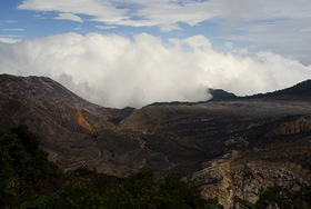 Edge of the Crater
©2006 (view
detail) |
Upon
reaching the summit around 9:30 in the morning, the clouds began to cover
the crater, a normal event during the rainy season. The air smelled of sulfur
but was moist and cool.
The surrounding area is known for coffee plantations due to the cool moist air and volcanic ash in the soil. PHOTOGRAPHS: |
||||
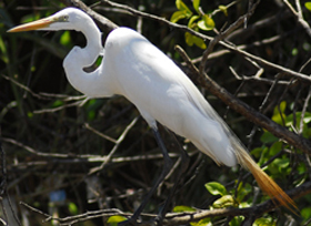
Carara and the Tarcoles
River are in an area considered a climatological transition zone where
dry northerly and humid southerly ecosystems meet. An ideal environment
for providing a wide range of animal, reptiles, amphibians and bird life.
MULTIMEDIA:
|
|||||
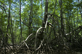
| DAMAS MANGROVES | |||||
Mangrove trees, which live
along the Pacific coast thrive in salty environments because they
are able to obtain fresh water from saltwater. Some secrete excess salt
through their leaves, others block absorption of salt at their roots.
Along the shore we saw many monkeys, Green Iguanas, and other reptiles, such as a Rainbow Boa Constrictor and a Baslik Lizard. PHOTOGRAPHS: |
|||||
| PARQUE NACIONAL MANUEL ANTONIO | |||||
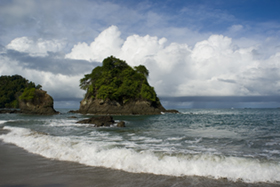 Manuel Antonio Beach ©2006 (view detail) |
This was one of the most popular parks we
visited, with many tourists. Although very beautiful, one feels the
true eco-tourism draw here.
The forest comes down to the Pacific, one of the reasons for it's popularity. It's also very common for White-faced Capuchins to snatch a tourist knap-snack and dump their belongings on the ground from high-up in a tree. PHOTOGRAPH: | ||||